
Apps
Travel & Local
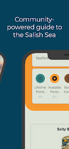
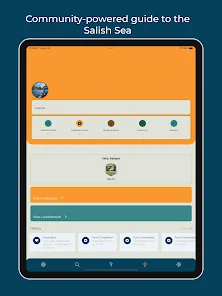
Salty
Salty

| Package ID: | |
|---|---|
| Latest Version: | v26.02.18 |
| Latest update: | May 24, 2026 09:15:04 |
| Developer: | The Number |
| Requirements: | Android |
| Category: | Travel & Local |
| Size: | 112.00 MB |
| Tags: | Navigation Photo Date |
Rating :4.0
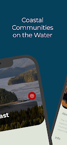
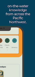
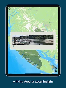
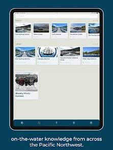
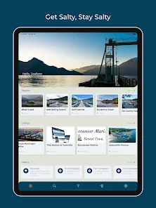
Salty is a community-powered guide for the Salish Sea that brings real-time, on-the-water knowledge to anyone planning coastal travel in the Pacific Northwest. The Salty app connects mariners, paddlers, ferry travellers and coastal explorers so they can share observations, local conditions and practical tips before heading out; this makes it easier to anticipate what you will find at a landing, inlet or ferry terminal. Whether you are preparing a short paddle, a weekend cruise through the Gulf Islands or a routine ferry trip, Salty helps you see recent reports from people actually on the water so you can make safer and more informed choices.
Features and how they work
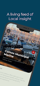
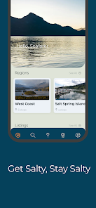
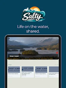
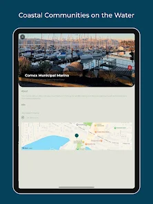
Salty gathers time-stamped community reports and displays them on an interactive map and in a recent-activity feed. Reports typically include brief text, photos and a location pin so you can quickly assess visibility of the shoreline, access conditions, hazards or wildlife sightings. The app supports quick report submission with a compact form, letting contributors add a category (for example: landing access, surf conditions, ferry notes, wildlife) and an optional photo. Map controls are familiar and mobile-friendly: tap markers to open full report details, pinch to zoom, pan to explore, and use simple filters to show only the report types most relevant to your trip.
Trip planning, filters and progression
For planning, Salty provides recent sightings and condition notes that can be filtered by activity type (kayak, small boat, ferry) and by how recent the report is, so you can prioritize the freshest information. Bookmarking or saving a location lets you build a short trip plan and return to it later; saved locations show the newest community updates at a glance. Progression in the app is practical rather than gamified: consistent contributions from local users lead to richer coverage of specific areas over time, which benefits everyone planning trips in those places.
Map layers, visual style and accessibility
The app uses clear, contrast-friendly map layers to present markers and report clusters without cluttering the view. Users can switch between a simple navigation layer and photographic imagery where available, helping you judge shoreline features and access points visually. Salty’s design emphasizes readable typography, large tap targets and support for system text-size settings so people with different visual needs can interact with the map and reports comfortably. Color choices and marker shapes were selected to remain distinguishable for common forms of color vision deficiency.
User experience, controls and offline options
Controls are optimized for on-the-go use: reporting uses short, focused fields and optional photo uploads so you can post observations quickly between tasks. The app offers basic offline caching for trip planning—download an area’s map tiles and recent reports before you leave cell coverage so you can review them while offshore. Notifications are optional; you can choose to receive updates for specific bookmarked locations or follow a route’s recent activity. The interface is intentionally uncluttered to reduce distraction while you’re preparing or navigating.
Use cases, replay value and limitations
People rely on Salty for a range of outings: scouting a new kayak inlet, checking landing access for a small-boat trip, monitoring ferry terminal conditions, or tracking weekend wildlife sightings. Replay value comes from the continuous, evolving stream of community observations—each outing is different and new reports make repeated use worthwhile. Coverage depends on local contributors, so some areas will accumulate detailed notes quickly while others remain sparse; Salty is a supplement to official navigation or weather services, not a substitute when safety-critical decisions are required.
Privacy and contributor guidance
Contributors control how much location detail they share and are encouraged to post concise, factual observations: time, place, and what they saw or experienced. Reports with photos help the community verify conditions visually, and timestamps make it straightforward to judge recency. The app respects user privacy and provides clear settings for notification preferences and saved-location visibility.