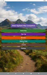


West Highland Way
| Package ID: | |
|---|---|
| Latest Version: | v1.2.1 |
| Latest update: | May 23, 2026 09:21:04 |
| Developer: | West Highland Way |
| Requirements: | Android |
| Category: | Lifestyle |
| Size: | 30.00 MB |
| Tags: | Travel Navigation Photo |
Rating :4.0
West Highland Way helps walkers navigate and record Scotland's most famous long-distance trail with confidence. This app bundles a complete offline map of the 154 km (96 mile) West Highland Way, live GPS positioning, simple route tracking and a built-in walking journal so you can stay oriented and capture memories even where there is no mobile signal. Hikers planning the route or already on the trail will appreciate the offline navigation, progress monitoring and the ability to attach photos and geotagged journal entries — making it an essential tool for a well-documented Highland walk.
Key Features
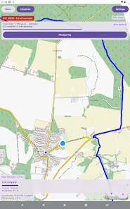
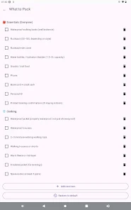
⭐ Full offline map of the West Highland Way route (154 km / 96 miles), included for use without mobile signal.
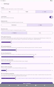
⭐ Live GPS positioning and clear route tracking so you always know your location on the trail.
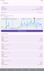
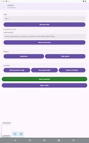
⭐ Built-in walking journal with geotagged entries and the option to attach photos to each day.
⭐ Journal pins appear as markers on the map for quick preview and location-based memory recall.
⭐ Export tools let you save or share your journal entries to keep a permanent record of the journey.
Advantages
✅ Works entirely offline along the full route, making it dependable in remote Highland sections.
✅ Simple, focused interface created specifically for walking the West Highland Way, from Milngavie to Fort William.
✅ Progress tracking helps you monitor distance travelled and your position relative to the route.
✅ Journal and photo support turn the app into both a navigation tool and a travel diary you can export.
Disadvantages
❎ Limited to the West Highland Way route, so it isn't a general-purpose mapping tool for other regions.
❎ Accurate tracking depends on your device's GPS and battery, so long days require power management.