

Apps
Productivity
PRIME Agrotecnologia
PRIME Agrotecnologia

| Package ID: | |
|---|---|
| Latest Version: | v1.0.0 |
| Latest update: | May 28, 2026 10:11:03 |
| Developer: | Agricultura de Informação |
| Requirements: | Android |
| Category: | Productivity |
| Size: | 66.94 MB |
| Tags: | Common System Date |
Rating :4.3
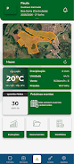
PRIME Agrotecnologia is a client-only application that brings precision agriculture tools to technicians and rural producers, concentrating georeferenced field data, remote sensing inputs and geostatistical analysis into a single mobile workflow. The app targets users who need to transform heterogeneous inputs — yield maps, soil samples, satellite indices and field observations — into prioritized recommendations for soil fertility and plant nutrition, and its interface is optimized for technicians working alongside producers in the field. Access to PRIME Agrotecnologia is restricted to authorized clients and the app performs best on modern devices that meet the recommended hardware profile.
Key features
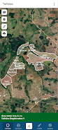
PRIME Agrotecnologia centralizes spatial layers and observational records so technicians can visualize variability across a property, compare historical productivity trends and generate targeted prescriptions. Core functionality includes the aggregation of remote sensing tiles and field-sampled points, geostatistical interpolation to reveal spatial variability, and decision-support modules that translate analytical outputs into fertilizer and amendment distribution guidance. The app also supports map layering, attribute filtering and simple export formats for sharing results with farm management systems or printing field reports.
How it works and interaction model
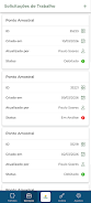
The app follows a workflow-driven design where users create a project, add map layers, and progressively refine analyses through a sequence of steps: import or capture georeferenced points, assign laboratory results or observational notes to those points, run spatial interpolation routines and review the resulting variability maps. Controls are touch-first: pinch and pan gestures navigate maps, long-press and tap gestures access context menus for data points, and clear on-screen controls allow toggling layers, adjusting interpolation parameters and applying classification thresholds. The interface is built to reduce repetitive data entry and to enable rapid decision cycles during field visits.
Progression, outputs and replay value
Progression within PRIME Agrotecnologia is driven by accumulating field data and improving model inputs. As users add more samples, satellite dates or historical yields, the interpolation and prescription outputs become more robust; this creates a natural progression in analysis quality rather than a game-like leveling system. Revisitability is supported by stored project histories, so technicians can compare seasons, test different interpolation methods or tune prescription rules and immediately see how recommendations change. The ability to re-run analyses with adjusted parameters encourages iterative refinement and continual improvement of management plans.
User experience, visual style and accessibility
The visual style favors clear map contrasts and clean data overlays so spatial patterns are legible on mobile screens under variable light. Color ramps for variability and productivity are customizable to accommodate color vision considerations and to match local agronomic conventions. Fonts, control sizes and map symbol scales adapt to screen density to aid readability, and the app includes settings to simplify interfaces for less experienced users or to expose advanced parameters for trained technicians. Onboarding tooltips and contextual help are integrated to reduce training time while maintaining access to advanced geostatistical options.
Offline capability and device requirements
Designed for field conditions, PRIME Agrotecnologia supports offline data collection and local caching of base maps, so users can work without continuous connectivity and synchronize results later when a connection is available. Because heavy raster tiles and interpolation calculations can be resource-intensive, the app requires a modern device (Android 9.0 or later, at least 4GB RAM and an octa-core processor recommended) and performs best when paired with compatible GNSS receivers or external sensors for higher positional accuracy. The app avoids unnecessary background processing to conserve battery during long field campaigns.
Compatibility with workflows and data formats
The application accepts common geospatial and tabular formats typical of agronomic workflows so technicians can import laboratory CSVs, shapefiles or simple coordinate lists collected in the field. Output formats are kept straightforward to ensure compatibility with desktop GIS or farm management tools: common raster and vector exports and CSV summaries of prescriptions or sampled points are supported. These practical import/export options are intended to fit into existing farm decision cycles rather than to lock users into proprietary systems.
Development team
Bentevi, the team behind PRIME Agrotecnologia, focuses on combining practical field experience with geostatistical methods to support technicians and producers across Brazil. The development approach emphasizes transparency of methods, incremental improvement through user feedback and documentation that explains algorithm choices and assumptions so that technical users can make informed decisions when applying recommendations in the field.