
Karttaselain

| Package ID: | |
|---|---|
| Latest Version: | v2.6.53 |
| Latest update: | Mar 09, 2026 13:08:03 |
| Developer: | AccelBit Oy |
| Requirements: | Android |
| Category: | Lifestyle |
| Size: | 46.20 MB |
| Tags: | Navigation Photo Date |
Rating :4.3
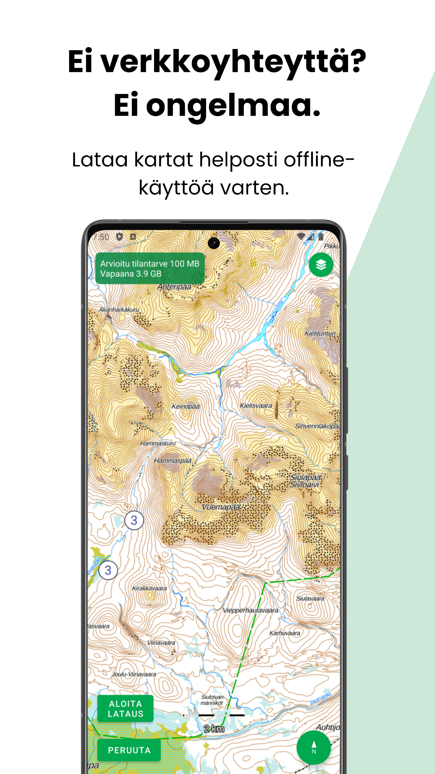
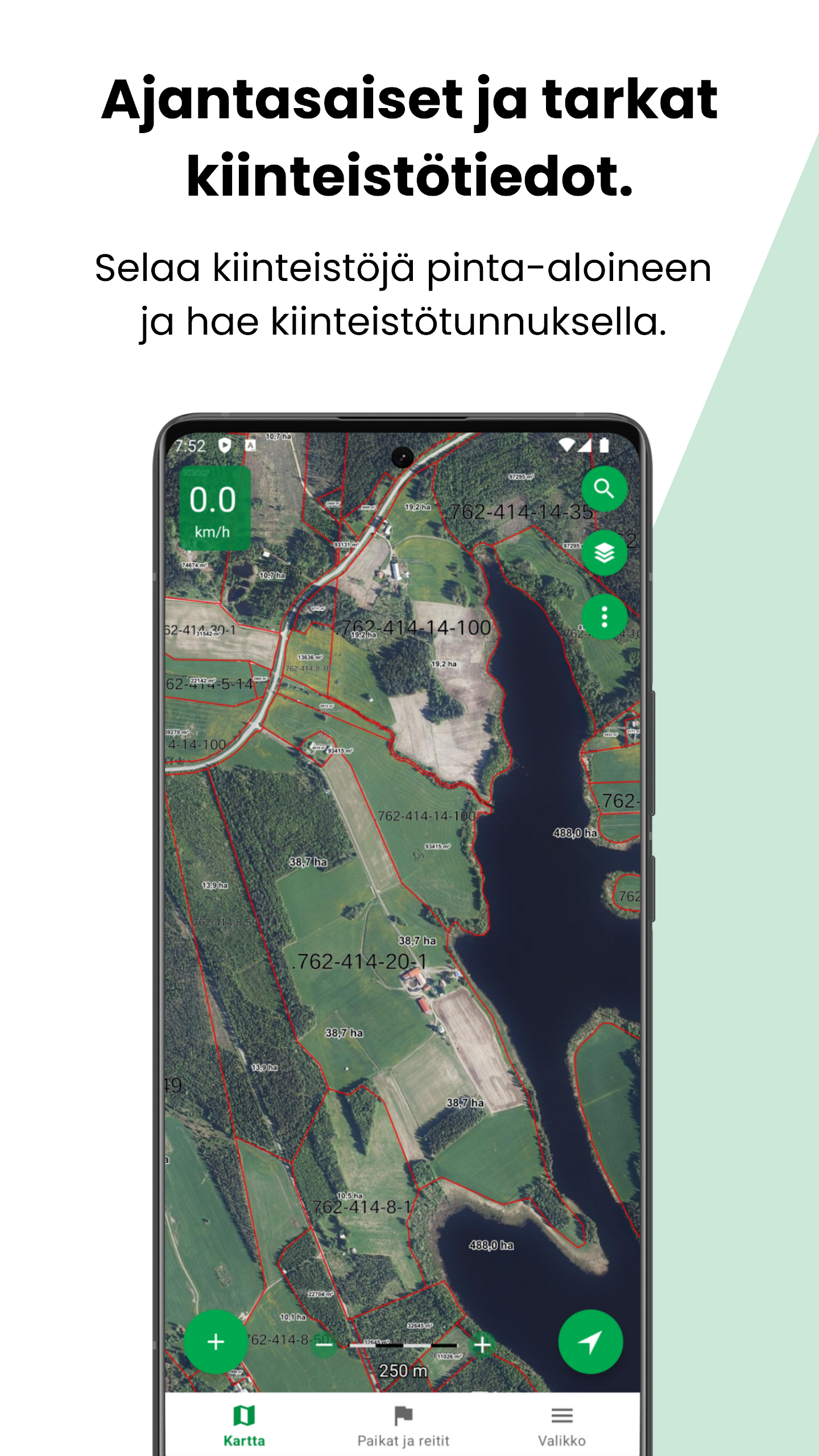
Karttaselain is an offline-capable terrain and marine GPS app that delivers Finland’s most accurate topographic maps, aerial photos and urban maps to your device, making it useful for hikers, boaters, landowners and outdoor planners. The app combines official National Land Survey maps, extensive aerial imagery and hiking resources—shelters, ski and snowmobile routes—together with GPS tracking, compass functions and route saving. The free version already includes basic depth contours and property boundaries, while a Plus subscription unlocks detailed marine charts, continuously updated property data and convenient offline map downloads for reliable navigation away from mobile coverage.
Key Features
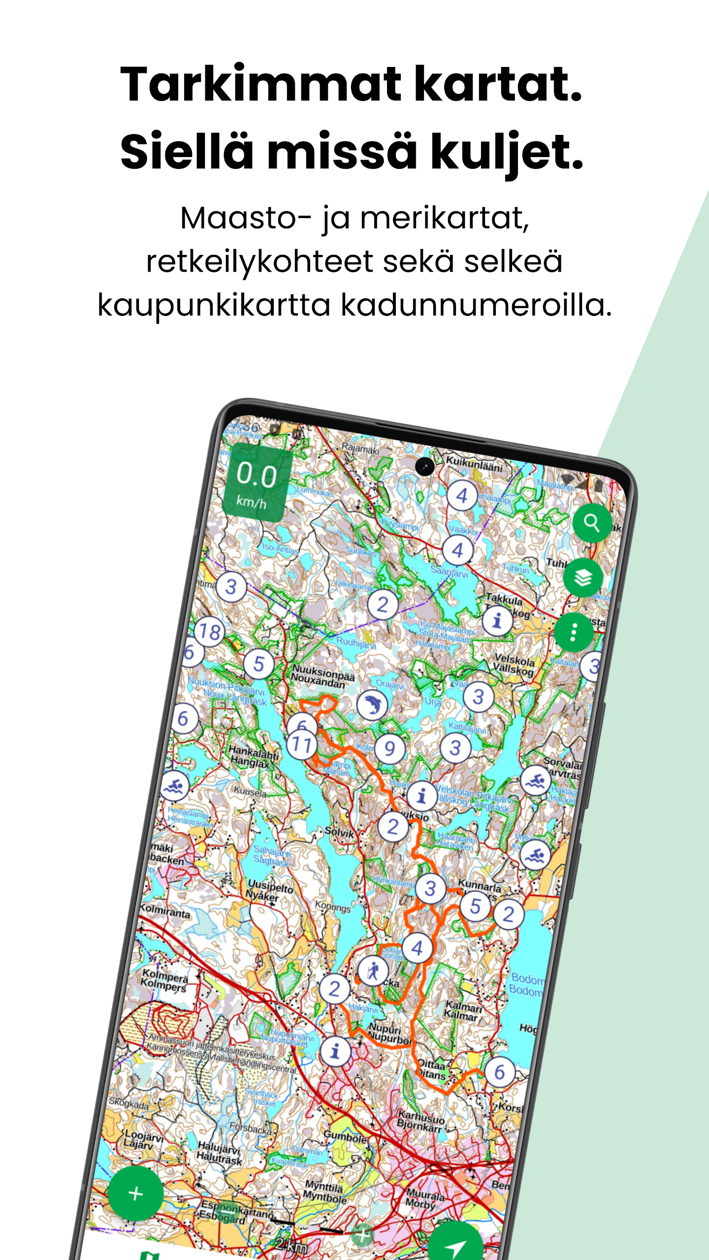
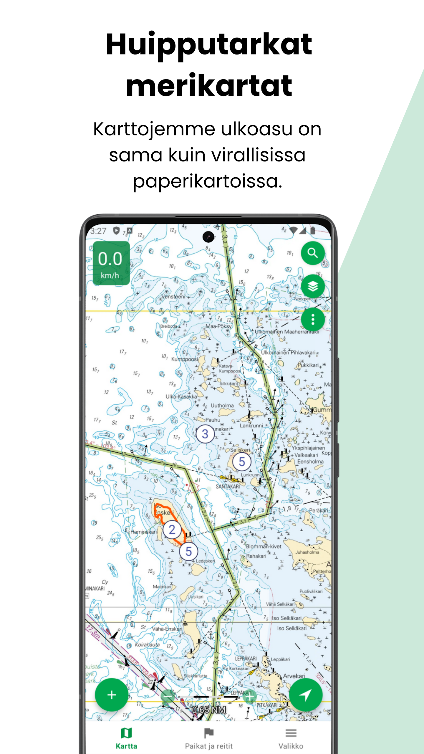
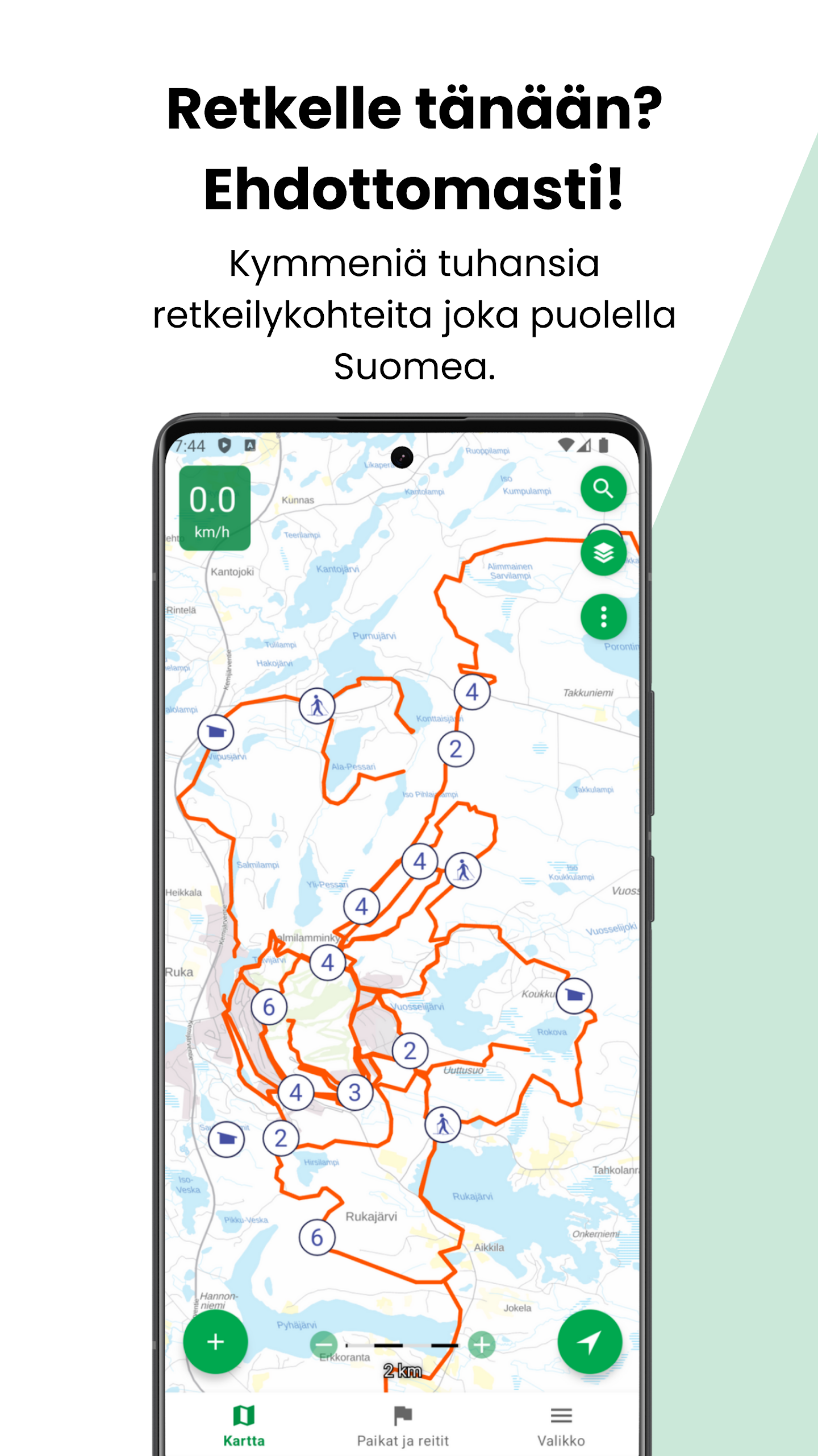
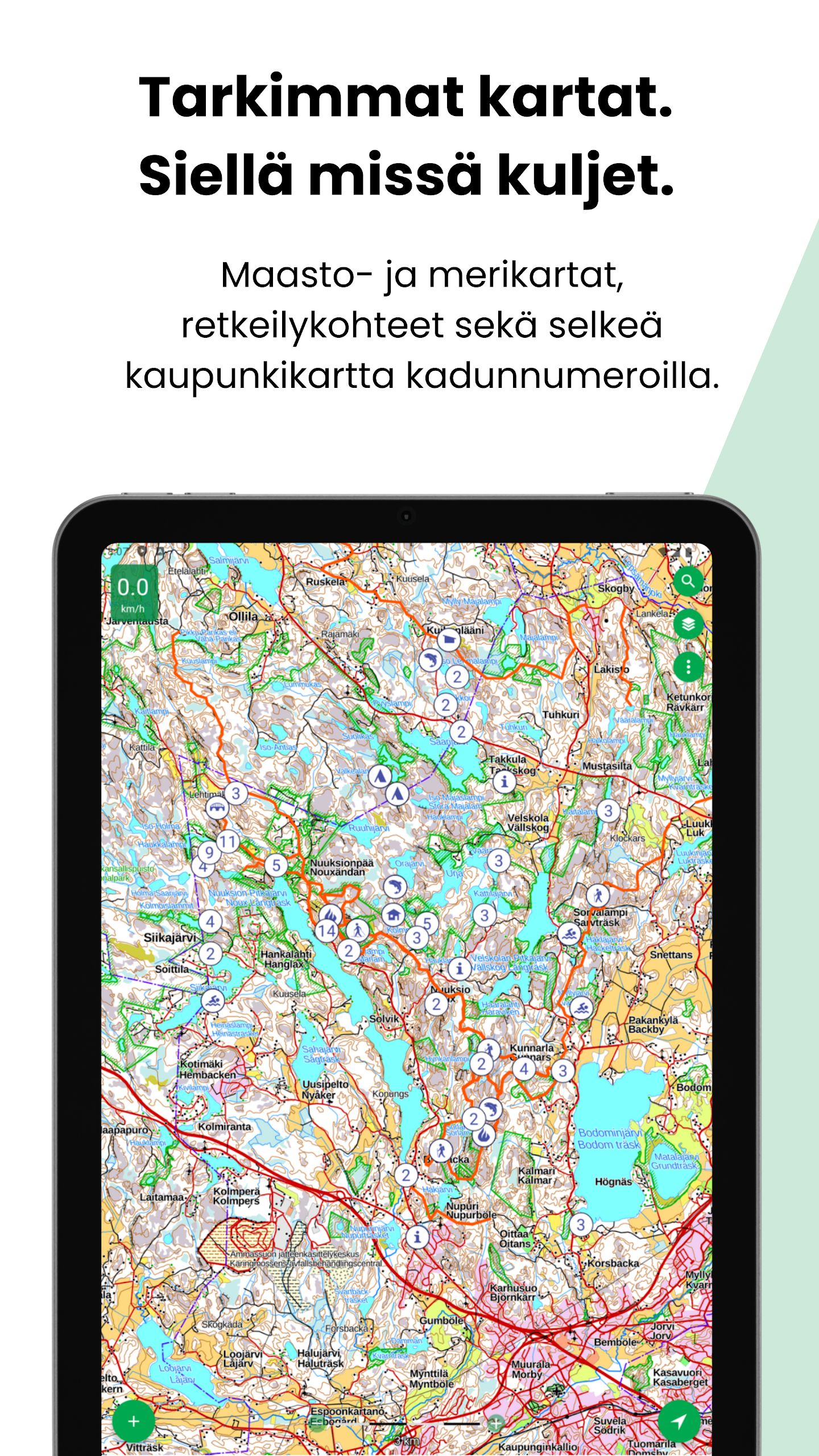
⭐ Up-to-date National Land Survey topographic maps and an excellent Norwegian topographic map for hiking.
⭐ High-resolution aerial imagery and town maps that include street names and numbers.
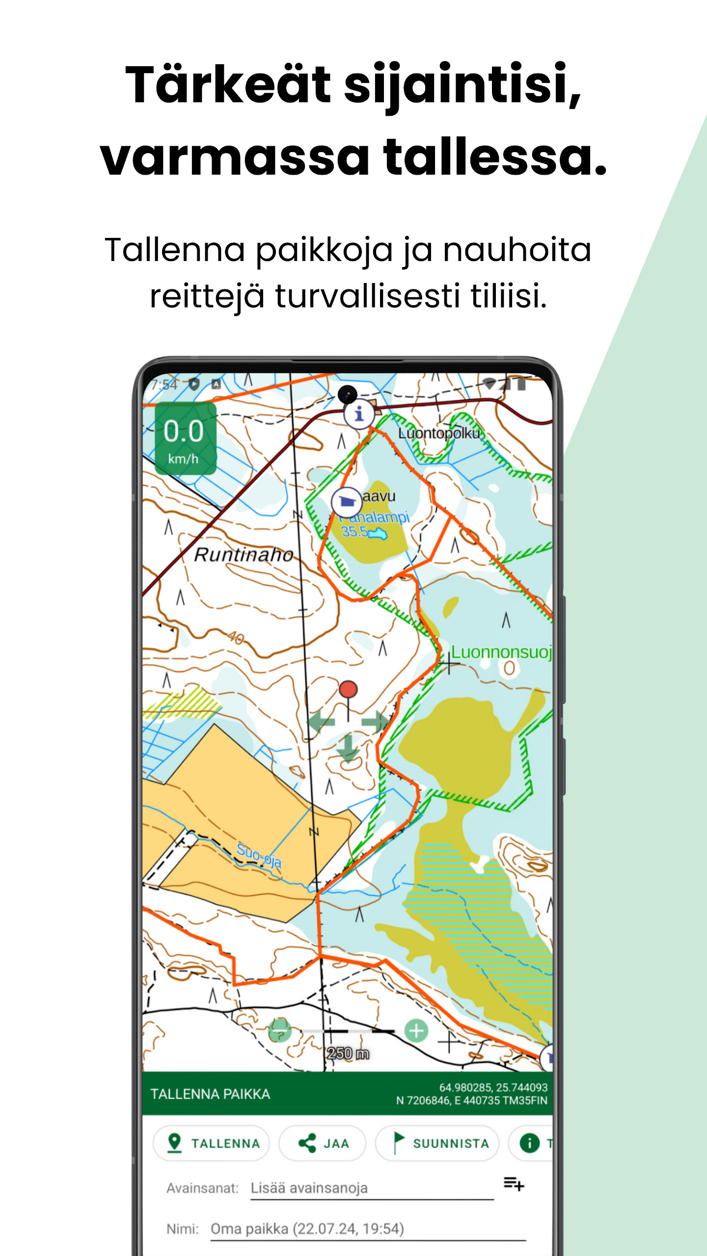
⭐ Karttaselain lets you save, organize and import/export places and routes in GPX format.
⭐ GPS tracking, speed display, map rotation to direction of travel, compass and directional line with distance to a target (requires device sensors).
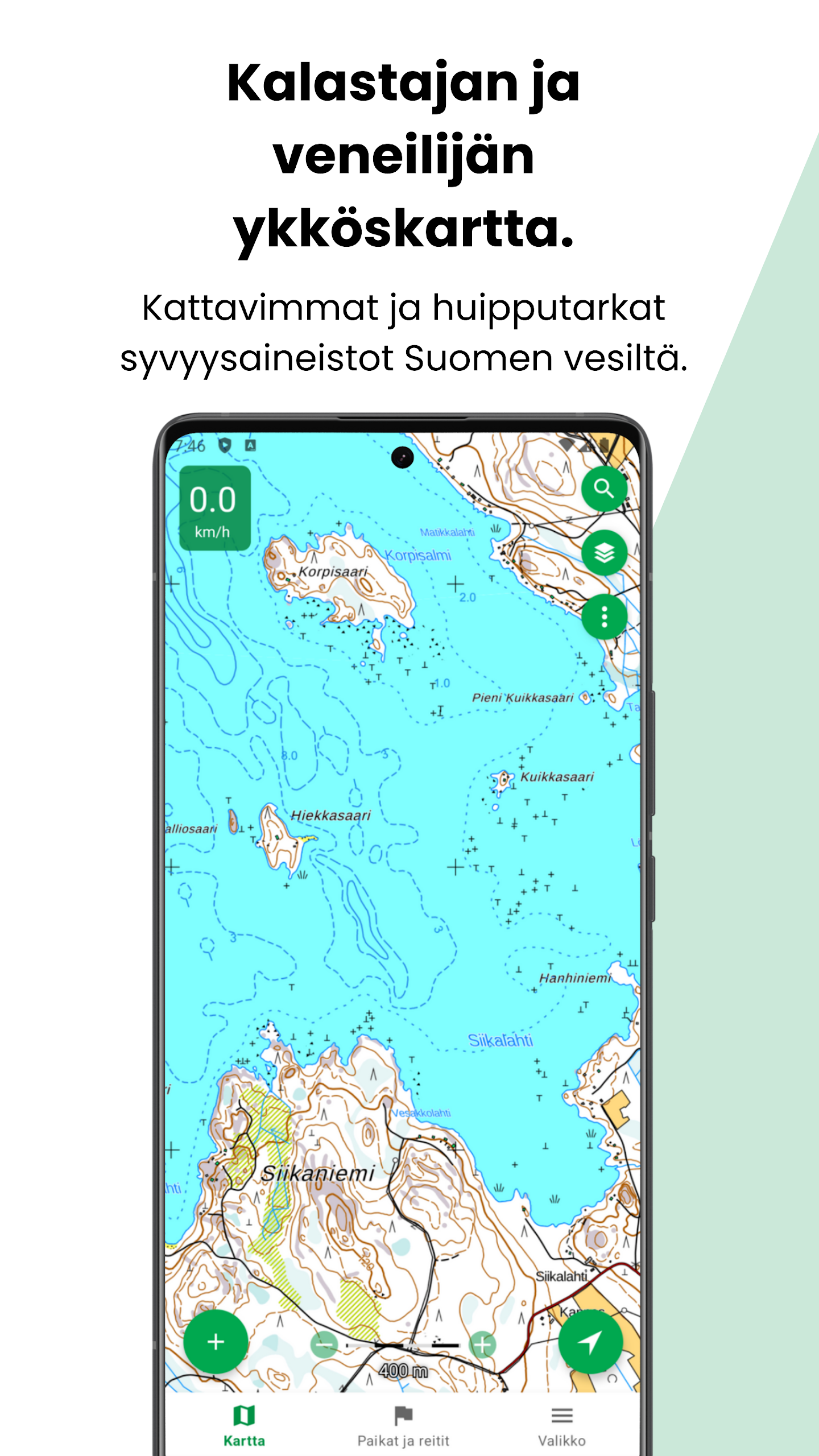
⭐ Basic depth contours and property boundaries are available for free; Plus provides the most comprehensive marine depth charts and continuously updated property records.
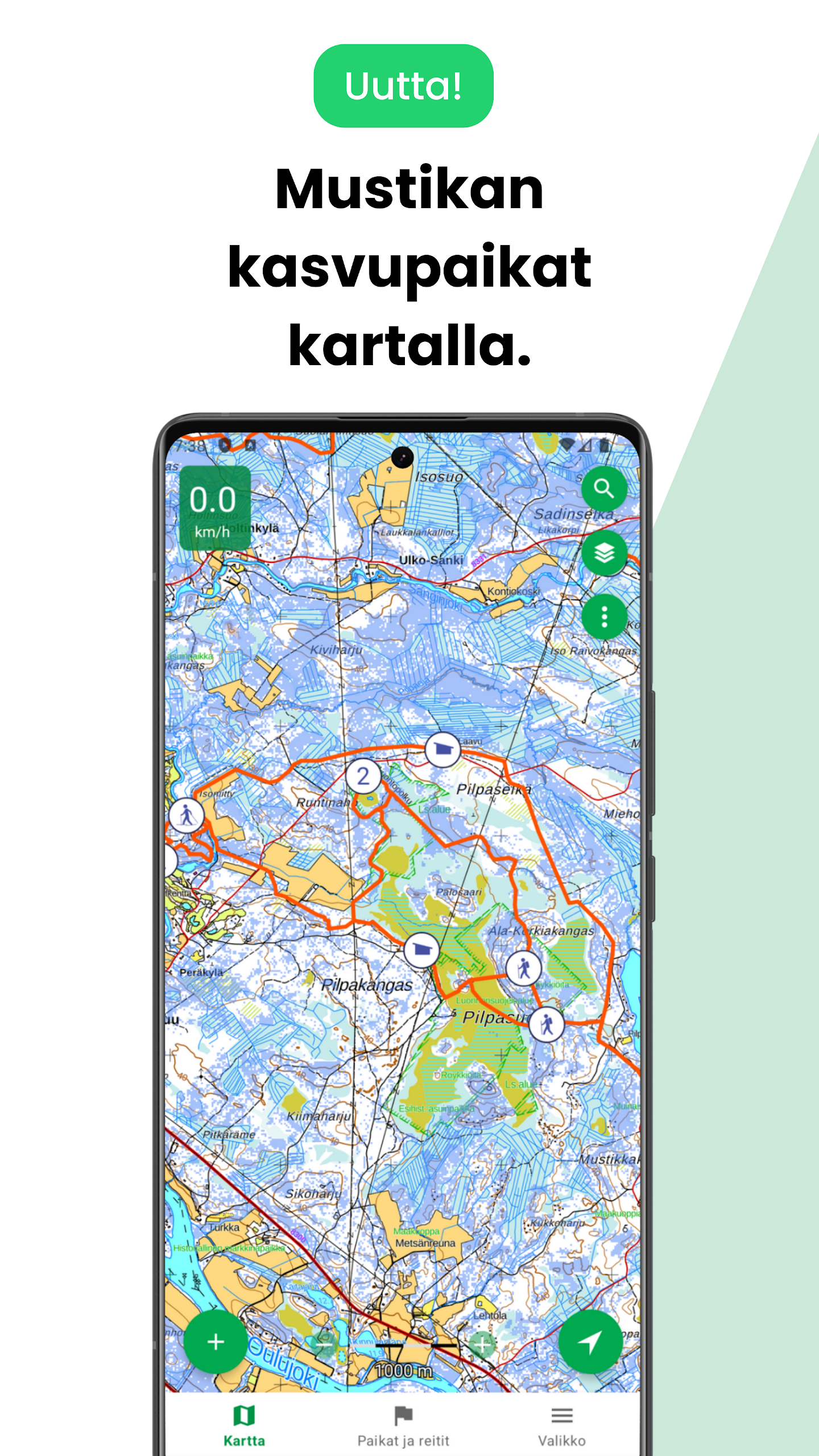
⭐ Map feedback tool allows users to suggest map updates, and new hillshade and forest orthophoto layers enhance terrain visualization for Plus subscribers.
Advantages
✅ Official, regularly updated map data from national authorities ensures trustworthy navigation and planning.
✅ Offline downloads, synchronized waypoints and route storage (with Plus) let you use the app across multiple devices without constant connectivity.
✅ Advanced marine charts, hillshade and forest orthophotos support boating, fishing and detailed terrain analysis.
✅ A 14-day free trial and clear subscription options make it easy to test Plus features, with customer support available if you need help.
Disadvantages
❎ Detailed marine depth data and continuously updated property boundaries are restricted to the Plus subscription.
❎ Full offline map downloads and advanced layers like hillshade and forest orthophotos require a paid upgrade.
❎ Several navigation features depend on the device GPS and digital compass, so accuracy varies with hardware quality.
Development Team
Karttaselain is developed in collaboration with its user community and maintained by a team that provides customer support and listens to user feedback to improve maps and features over time.
Version Information
Recent updates added slope shading (hillshade) and forest orthophotos to enhance terrain shaping and vegetation detail; these new layers are available to Plus subscribers and during the trial period.