


swisstopo

| Package ID: | |
|---|---|
| Latest Version: | v1.14.1 |
| Latest update: | Mar 18, 2026 09:09:03 |
| Developer: | |
| Requirements: | Android |
| Category: | Other |
| Size: | 97.14 MB |
| Tags: | System Navigation Read |
Rating :4.1
swisstopo provides official Swiss topographic maps and location tools for planning, navigation and outdoor activities. The swisstopo app offers high-resolution map layers, reliable coordinate displays and tools for measuring distances and elevations.
Key features
- Official topographic maps and aerial imagery with selectable layers for terrain, cadastral and landscape views.
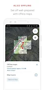
- GPS-based location display and coordinate readouts in multiple systems, with optional offline map tiles.
- Route planning, distance and area measurement, elevation profiles and waypoints suitable for hiking and cycling.
- Search for addresses, places and map coordinates, plus bookmarking and simple sharing of locations.
Usage and data
The swisstopo app is designed for reliable field use with clear map legends and data source attribution. swisstopo map data is maintained by the national mapping authority; consult the app settings for offline data management and licensing information.